
Gemiddeld laagste grondwaterstand bij scenario "huidig" in Mastenbroek
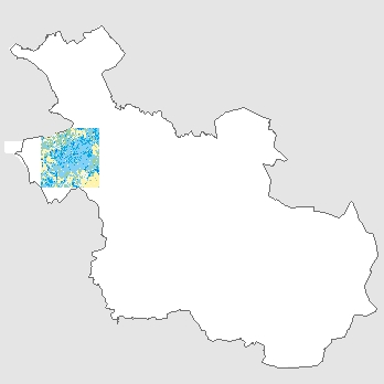
Dit bestand toont de gemiddeld laagste grondwaterstand bij scenario "huidig" in Mastenbroek. De gegevens zijn afkomstig uit de studie Verkenning Bodemdaling NoordWest-Overijssel. Deze studie heeft firma Infram voor de provincie Overijssel en het waterschap Drents Overijsselse Delta verricht in de periode 2017–2019.
Standard
dataIdentificatie
- Title
-
Gemiddeld laagste grondwaterstand bij scenario "huidig" in Mastenbroek
- Date (Creation)
- 2018-12-01
- Date (Publication)
- 2023-08-09
- Date (Revision)
- 2018-12-01
- Unique resource identifier
-
27dd85a5-0ccd-43ed-96bc-b381d0545b45
- Status
- Completed
- Metadata language
- Nederlands; Vlaams
-
Thesaurus van Overijssel
-
-
bodem
-
Constraints
- Use limitation
-
Data mag alleen met verklaring uitgeleverd worden
- Use limitation
-
Geoportaal extern
- Access constraints
- Intellectual property rights
- Point of contact
-
individualName organisationName electronicMailAddress role contact
INFRAM
Owner
spatialInfo
))
- Denominator
- 10000
- Distance
- 50 meters
- referenceSystemIdentifier
-
https://www.opengis.net/def/crs/EPSG/0/https://www.opengis.net/def/crs/EPSG/0/28992
DataQuality
- Hierarchy level
- Dataset
- Lineage
-
Studie Verkenning Bodemdaling NoordWest-Overijssel die Infram voor provincie Overijssel en het waterschap Drents Overijsselse Delta heeft verricht in de periode 2017 – 2019.
Metadata
- Metadata language
- Nederlands; Vlaams
- Hierarchy level
- Dataset
- Metadata author
-
individualName organisationName electronicMailAddress role team Data, Informatie, GIS en Innovatie
Provincie Overijssel
Custodian
Overviews
)))
Provided by
