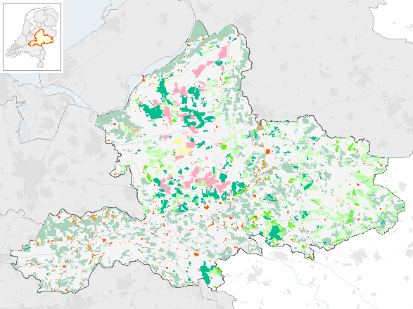
Cultuurhistorie- Relictenkaart vlakken
Cultuurhistorische vlakinformatie met waarderingskaart agrarische hoofdfuncties (open essencomplex, weinig veranderd cultuurland na 1850, tussen 1850-1950 ontgonnen gebied na 1950 weinig veranderd, heiderelicten 1850, bosrelicten 1850, zandverstuivingsrelicten 1850, en bebouwingskernen 1994, water 1994). Deze kaart geeft alleen in combinatie met de relicten-symbolen en relicten-lijnen een volledig beeld van Gelderland v.w.b. relicten.
Standard
dataIdentificatie
- Title
-
Cultuurhistorie- Relictenkaart vlakken
- Date (Creation)
- 2002-04-10
- Date (Revision)
- 1995-01-13
- Unique resource identifier
- 7f656e53-480f-469c-80d0-d9127b03e3c1
- Status
- Completed
- Metadata language
- Nederlands; Vlaams
-
Datatypering
-
-
Data product
-
-
Integriteit
-
-
Midden
-
-
Vertrouwelijkheid
-
-
Openbaar
-
-
Interprovinciale thesaurus
-
-
ARCHEOLOGIE
-
CULTUURHISTORIE
-
CULTUURHISTORISCHE WAARDENKAARTEN
-
- Use limitation
-
Geen gebruiksbeperkingen
Legal constraints
- Access constraints
- Other restrictions
- Other constraints
- Geo Gedeeld licentie
spatialInfo
))
- Denominator
- 50000
- referenceSystemIdentifier
DataQuality
- Hierarchy level
- Dataset
- Lineage
-
Afgeleid van analoge kaart
Metadata
- Metadata language
- Nederlands; Vlaams
- Hierarchy level
- Dataset
- Metadata author
-
individualName organisationName electronicMailAddress role ProvincieLoket
Provincie Gelderland
Point of contact
)))