
Landschapstypen
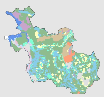
Landschapstypen in Overijssel. Bestand met een indeling naar landschapstypen in Overijssel. Dit bestand is samengesteld door Stichting Het Oversticht en gebruikt voor de cultuurhistorische atlas van Overijssel. De grondslag van dit bestand is de digitale bodemkaart van Nederland 1:50000 en oude topografische kaarten.
Standard
dataIdentificatie
- Title
-
Landschapstypen
- Date (Creation)
- 2002-02-07
- Date (Publication)
- 2024-08-29
- Date (Revision)
- 2002-02-07
- Unique resource identifier
-
983543b5-740a-4693-aa88-cdc9de52422e
- Status
- Completed
- Metadata language
- Nederlands; Vlaams
-
Interprovinciale thesaurus
-
-
cultuurhistorische waardenkaarten
-
Constraints
- Use limitation
-
Geen gebruiksbeperkingen
- Use limitation
-
Geoportaal extern
- Use limitation
-
Downloadable data
Legal constraints
- Access constraints
- Other restrictions
- Other constraints
- Other constraints
-
Geo Gedeeld licentie
- Point of contact
-
individualName organisationName electronicMailAddress role team Data, Informatie, GIS en Innovatie
Provincie Overijssel
Owner
spatialInfo
))
- Denominator
- 50000
- referenceSystemIdentifier
DataQuality
- Hierarchy level
- Dataset
- Hierarchy level
- Dataset
- Lineage
-
Provincie Overijssel: eenheid Natuur en Milieu
Metadata
- Metadata language
- Nederlands; Vlaams
- Hierarchy level
- Dataset
- Metadata author
-
individualName organisationName electronicMailAddress role team Data, Informatie, GIS en Innovatie
Provincie Overijssel
Owner
Overviews
)))
Provided by
